Social Scientists Map Chicago
Geographer Chauncy Harris often argued that Chicago in the first half of the 20th century was the most studied city in the world. This claim is unprovable, but there were certainly an enormous number of scholarly studies of Chicago between the 1920s and the middle of the 20th century. Many of these included maps.
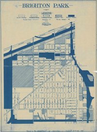
This Web site provides links to a few of the social science maps of Chicago that are held as separate pieces by the University of Chicago Library's Map Collection. Included here are several products of the "Chicago School of Sociology" including the Social Base Map of Chicago; a group of anonymous neighborhood maps; several maps of land use or land value by (or connected with) Homer Hoyt; and maps from books by Frederic Thayer on gangs, Walter Reckless on "vice," and Clifford Shaw on crime. These maps were created during the 1920s and the 1930s, at more or less the same time as another Chicago School product, the Social Science Research Committee census maps. It is arguable that, at the moment of their creation, the Chicago School maps made up the most wide-ranging cartographic portrait of an urban area that had ever been compiled.
Also included are several of geographer Harold Mayer's railroad maps; anthropologist Sol Tax's manuscript cartographic representation of blockbusting in the Hyde Park area; and other maps as well.
Reproduction Rights
This collection is licensed under a Creative Commons Attribution-ShareAlike 4.0 License, except for materials published prior to 1924, which are in the public domain.
Browse Collection
Browse this collection in the Library Catalog Browse all maps by subject
Map of Chicago, showing original subdivisions, 1830 to 1843 / prepared by Homer Hoyt from ante-fire plats of the Chicago Title and Trust Company.
Publication date: 1843
Land use Real property Chicago Illinois
Map of Chicago showing land values, 1836 : average values for each square mile in dollars per acre / [Homer Hoyt].
Publication date: 1836
Real property Chicago Illinois
Map of Chicago, showing original subdivisions, 1844 to 1862 / prepared by Homer Hoyt from ante-fire plats of the Chicago Title and Trust Company.
Land use Real property Chicago Illinois
Tuberculosis in a congested district in Chicago, Jan. 1st, 1906, to Jan. 1st, 1908, including the district represented in chart 1, population chiefly Jewish / by Theodore B. Sachs.
Near West Side (Chicago, Ill.) Tuberculosis Chicago Illinois
East and West Garfield Park.
East Garfield Park (Chicago, Ill.) West Garfield Park (Chicago, Ill.)
Englewood and West Englewood / prepared by Department of Sociology, University of Chicago.
Englewood (Chicago, Ill.) West Englewood (Chicago, Ill.)
Map of Chicago, showing original subdivisions, 1830 to 1843 / prepared by Homer Hoyt from ante-fire plats of the Chicago Title and Trust Company.
Publication date: 1843
Land use Real property Chicago Illinois
Map of Chicago showing land values, 1836 : average values for each square mile in dollars per acre / [Homer Hoyt].
Publication date: 1836
Real property Chicago Illinois
Map of Chicago, showing original subdivisions, 1844 to 1862 / prepared by Homer Hoyt from ante-fire plats of the Chicago Title and Trust Company.
Land use Real property Chicago Illinois
Tuberculosis in a congested district in Chicago, Jan. 1st, 1906, to Jan. 1st, 1908, including the district represented in chart 1, population chiefly Jewish / by Theodore B. Sachs.
Near West Side (Chicago, Ill.) Tuberculosis Chicago Illinois
East and West Garfield Park.
East Garfield Park (Chicago, Ill.) West Garfield Park (Chicago, Ill.)
Englewood and West Englewood / prepared by Department of Sociology, University of Chicago.
Englewood (Chicago, Ill.) West Englewood (Chicago, Ill.)Access Location
Map Collection Reading Room (Room 370)Subject Specialist
Samuel B Brown
Map Assistant
sbb@uchicago.edu
773-702-8761
JRL 370